Cannibal Island!!!

nazino island

About 1,500 miles northeast of Moscow, you’ll find an island called Nazino. But after the calamity that occurred in 1933, it will forever be known as Cannibal Island. During Stalin’s reign of terror, he created “special settlements” in which criminals, unemployed people and those without proper paperwork were sent. Of course those were not the only people thrown on the island. Innocent children and pregnant ladies were forced to go too. Around 6,000 people were sent there but only a third came off the island. Now, what happened to the rest?

These unlucky souls were dumped on the island with nothing but each other. No drinking water, no shelter, no tools, absolutely nothing but some raw flour that was dumped on the beach. The first night temperatures dropped below zero and some died from exposure to the cold. But mainly, it was a game of starvation, a Hunger Games-like situation. Those who drank the contaminated water got dysentery which is an infection of the intestines. Those who tried to escape the island were shot and killed by the guards. If you ask me, getting shot by the guards seems to be the least painful death compared to what ensued on the island.

A few days in, the cannibals came out to play. They tore one another apart, limb by limb, aiming for the tenderest parts of the body. The victims remained alive until they died of blood loss or their head was ripped off. Keep in mind they had no tools, so this massacre happened with bare hands. The fields were soon covered in corpses and flesh was draped over tree branches.

As this was going on, Soviets continued dumping people on the island, knowing very well what their fate looked like. On the bright side, the “program” only lasted a month and the remaining survivors were removed from the island.

Here is a Youtube video I found regarding the events.

https://www.youtube.com/watch?v=4IV9d6586VQhttps://www.youtube.com/watch?v=4IV9d6586VQ

Posted in dangerous, island | 4 Comments

St. Thomas

St. Thomas is one of the three U.S. Virgin Islands located in the Caribbean. Even though it is only 32 square miles, there are many things to do. St. Thomas, like the other Virgin Islands, is a popular destination for Caribbean cruises. In fact, I had the privilege of visiting this beautiful piece of paradise in 2010 during my cruise.

St. Thomas features many land and marine activities, so there is never a shortage of things to do. Some of these attractions include:

The Beaches

St. Thomas has over 10 beaches, each with its own unique characteristics. Whether you want to be on the ocean, or on a bay, St. Thomas has a beach for you.

Family Fun

St. Thomas offers tours and activities that are fun for the whole family. Some of these include the St. Thomas Adventure Tour, where guests explore the western part of the island, Sky diving or Skyride, where passengers are carried 700 feet above the town of Charlotte Amalie for spectacular views and several botanical gardens and aquarium parks.

Museums and Historical Sites

The island, once occupied by the Danish, has a rich history. Fort Christian, built in 1680, was erected to protect the Danish settlement and is now a museum. People can also visit the Government House, built in 1867, and the Haagensen house, built in 1827. In addition to Danish history, the island was also allegedly involved with pirates. Tourists can visit Blackbeard’s castle, built  in 1679, or Bluebeard’s castle, built in 1689 and named after the fictitious pirate.

Fort Christian

Fort Christian

Blackbeard's Castle

Blackbeard’s Castle


Water Activities

The islands also takes advantage of the beautiful waters that surround it. Tourists have many opportunities to Snorkel or SCUBA dive at several sites throughout the island. Also, guests can participate in water sports like kayaking, windsurfing, wakeboarding, jet skiing, and sailing.

The Island at a Glance

The above pictures were taken by me while I visited the island in August 2010
Posted in Travel | 2 Comments

Native birds in New Zealand


New Zealand is a beautiful island/ country.  Here are some animals that you only can see there.

Kiwi

kiwi_bird

The kiwi is a nocturnal, flightless bird that lives on the forest floor. The kiwi are the only bird to have nostrils at the end of their bill, and forage for food by digging in the earth and smelling it out. The kiwi is the New Zealand national icon. Like eagles to the U.S. They appear on stamps, New Zealand dollar coins, and the logo of New Zealand Rugby League. Often times, New Zealanders call themselves Kiwis.

Weka

untitled

The weka is a cheeky, flightless bird that lives in a range of environments including forests, sand dunes and semi-urban areas. The weka are known to steal food and shiny objects from unwitting campers and travellers, and will eat just about anything.

Kaka

kaka

The Kaka is a lively parrot, with two sub species – one that inhabits the North Island and the other inhabiting the South Island. The kaka make use of their brush tongue, strong bill and feet in obtaining fruit, nectar and seeds.

Kakapo

Kakapo-2

The kakapo is a plump, flightless, nocturnal parrot. Unique in many ways, nests on the ground and only breeds every 2 to 4 years.

Albatross

black-browed-albatross_464_600x450

The albatross is a large seabird that spends most of its life at sea – returning to land only to breed and raise their young. Many albatross species have been brought to near extinction.

When I was visiting there, I only saw a few Albatross, unfortunately. However, I saw pictures of Kiwi and Weka everywhere. New Zealand people really love them.


I got this information from the following page,

http://www.lovenewzealand.net.nz/native-animals/

Here are two videos about Kiwis and Kakapo I found on YouTube.


https://youtu.be/Opv8vZ6RvB0


Posted in island, Travel | Tagged | 7 Comments

The Doomsday Seed Vault

seedvault3-mapHigh above the Arctic Circle on a Norwegian island is a special place in which seeds are kept as a safeguard of world wide loss of crops and climate change.  In the Svalbard archipelago there is a huge vault carved into the side of a mountain where seeds from plants from all over the world are kept.  Why?  Well to safeguard food supplies in the case of a disaster, natural or man-made.

The vault can store 4.5 millions varieties of crops, thereby safeguarding our planet’s plants, and our own future, in this frozen wasteland.  Think of it as a huge walk-in freezer but with humanity in mind.  This sounds like something oseedvalut1ut of a James Bond movie as we can imagine the value of this place, ever as we might be impressed by the oddity it represents.  What seeds would you put in there?


Posted in Uncategorized | Tagged , | Comments Off on The Doomsday Seed Vault

Long Island Living

20040928LIsland-thumb

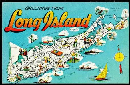
We all live here. We know our culture, what our norms are and what everyone has come to understand as a “Long Island thing.” It is interesting to take ourselves into perspective and really  observe the culture of our own island.

1Y3re

Montauk Point Lighthouse

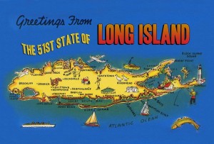
1.) We forget we’re an island. We are not a small island where we can see all of our beautiful beaches and borders from wherever we are on the island.  Long Island has an area of 1400 square feet, so it’s no wonder that we can’t see completely around the island at all times.

long-island-moving-company-nyc

2.) When we go anywhere out of state, no one knows where we are from. When we say Long Island, we have to explain that we are actually a part of New York, not the city like everyone automatically assumes either. From personal experience, I know that people find it very interesting when I tell them I’m from New York but are very confused when I say I live on Long Island.

map

3.) Our accents. You know it’s bad when you can pick up on your own accent while reading something, and it’s even worse when your friends make fun of the way you say certain words. For instance, if I put the word “coffee” here, I’m sure most of you Long Islanders would read “caw-fee.” However, anyone out of state may ask you to repeat that, considering it may be entertaining for them to here.

lawn_guyland_infant_bodysuit

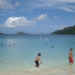
4.) Our beautiful beaches. Beach days are never complete without watching the sunset and taking your arsty Instagram picture of #LongIslandSunsets.

sunset_3_8_10

#LongIslandSunsets

hamptons-beach

#BeachDay

5.) Our ability to pronounce tribal names with ease because of the places we grew up. Many of us know the proper way to pronounce Quogue, Ronkonkoma, Massapequa, Hauppauge and Patchogue; however, what may seem normal to pronounce here is not as common elsewhere.

Quogue Sign

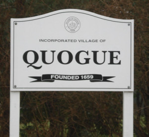
For non-native LI-ers, pronounced “kwag”
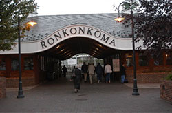
ronkonkoma-ny-11749-11779

ron-kon-kō-mah

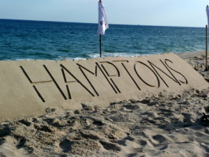
6.) You know that heading west on the LIE on a Sunday night is the biggest mistake you can make due to the ridiculous amounts of Hamptons traffic. And you also know that it’s called the LIE, not I-495.

West bound Long Island Expressway is one of the most congested highway in New York City located in Queens, New York on Monday, March 7, 2011. Original Filename: _H4G0748.jpg

Westbound traffic heading back towards NYC

7.) Our famous iced tea! Although we are not the typical Southern sweet tea, Long Island has become very popular for it’s mixed iced tea drinks. Not only is there the original Long Island iced tea, but there is also a blue iced tea for those who like to try something new.

456f1312596216eb631b26881dc50266

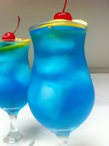
Blue Long Island Iced Tea

long-island-iced-tea

Long Island Iced Tea

8.) There is an immense amount of history that has taken place here on Long Island, as we were a part of the original 13 colonies in New York and we have had European settlement here dating back to the 1600s. Prior to Europeans arriving here, we had Native American tribes spread across the island, which is why we can still find many reservations around the island.

images

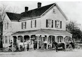
Old fashioned Oyster Bay home

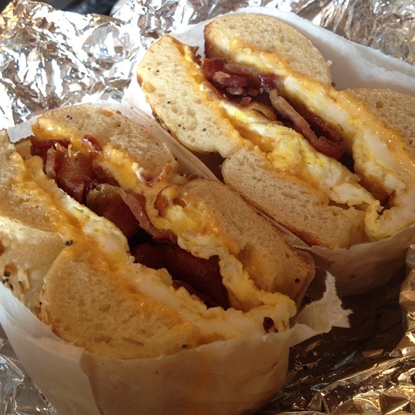
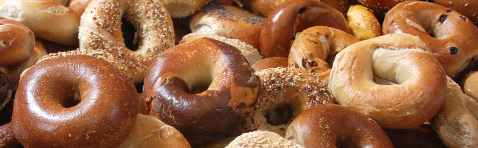
9.) Bagels! We love our bagels and we know that we have the best ones around. No matter which town you are from here on LI, I’m sure you know have at least one bagel place that you love to go to. Besides, there are so many kinds who doesn’t love bagels? Also, many like to make their bagels slightly more gorrmet by making it with eggs, cheese and bacon rather than the traditional cream cheese or butter.

bagels960 thumb_600

10.) Billy Joel has had a large influence on the lives of Long Islanders. From performing at the last show at Shea Stadium in the “Shea Goodbye” concert to getting the last performance at the Nassau Coliseum, this Oyster Bay local is the pride and joy of the LI community and his music remains a large part of our culture to this day.

billyjoel_shea

Billy Joel at Shea Goodbye

billyjoel

The Piano Man, himself

11.) Long Island Medium. We all know Theresa Caputo does not put out an accurate representation of an average Long Island woman, but she is yet another pop culture figure that Long Island has gained popularity for. Although I personally have not seen her, she can be spotted gallivanting around Long Island doing psychic readings.

theresa-caputo-62d9bd616b3f7b29

Theresa Caputo, “Long Island Medium”

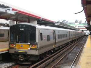
12.) The advantage of the Long Island Railroad, or the LI-double R as the locals call it, to get you back and forth from New York City, also just known as “The City,” is something many commuters use rather than driving through rush hour traffic to get to work every day. On the humorous side, the last train of the night on the LIRR has acquired the nickname “The Drunk Train” because of the types of commuters that can be found on the train at that hour. Many people are stumbling their way home after a long night in NYC clubs or bars.

LIRR_logo

lirr

13.) Last but not least, the amount of entertainment on Long Island is incredible. Anything you could think of doing is right here. Long Island is lucky enough to be an island where all four seasons are experienced each year, giving various opportunities for activities year round. In the Spring time, you can take advantage of the beautiful scenery coming back to life and visit the Big Duck or visit one of the many lighthouses out on the East End. In the Summer, many people make their way out to the Hamptons or to Montauk to visit the beaches, wineries or simply to shop, or they find themselves at one of our amusement parks, either Adventureland or Splish Splash. In the Fall, many take advantage of the ability to go fruit and pumpkin picking and go on spook walks. Although most of us may find ourselves indoors on those cold winter days, there is the possibility of sledding or ice skating in Port Jefferson at the Rinx.

pumpkin-pickingg

Pumpkin Picking

g_skating2

Ice Skating at the Rinx

hamptons2012

Summer Fun in the Hamptons

SplishSplash

Long Island’s Waterpark, Splish Splash

thumbnail253_adventureland-farmingdale_logo_1301083689

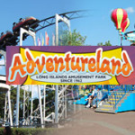
Many of us grew up making memories here at Adventureland


Sources:
http://www.iloveny.com/articles/view/long-island-fact-sheet/808/#.VgIB07RYbFI
http://www.barstoolsports.com/dont-use/dude-interviews-late-night-lirr-passengers-on-the-drunk-train/
Spring Fun on Long Island, NY. – About.com

Posted in island, tourism | Tagged , , , | 2 Comments

The Rockall Dispute

Rockall-photo crop.JPG


Ever heard of an Island called Rockall, probably not, and who would blame you it is a tiny uninhabitable rock in the Atlantic, no one lives there and life cannot be sustained there except for clams. Its approx. 56 feet above sea level and an approx. area of 8,442 sq. feet. Yet four countries all lay claim to the island, they are Britain (surprised?), Iceland, Denmark and Ireland. So what is so important about this island that has four countries fighting over it? It is not the island itself, but the continental plate it lays on, it contains natural gas, oil and minerals which each country wants.

So what is the rational of each claim? The Danish control another group of islands near by called the Faroe Islands, north of Scotland, they are approx. 609 km away from Rockall, and also have the least claim to the island compared to the other but does have a strong claim to the northern part of the Rockall Through, a part of the under water landmass near Rockall. Iceland is another country with a claim to the island and the underwater landmass but approx. 700 km away. The reason they have a greater claim then the Danish is the Icelandic control a large area of landmass that borders the Rockall plateau, another part of the under water landmass. Next is Irelands claim to Rockall and the landmass. It is 432 km off the coast of Tory Island, County Donegal, Ireland. At first the Irish government was not interested in the Island until England claimed the island in 1955 and it expanded the English control an extra 300 km from the nearest British controlled island of St. Kilda. While the Irish government has never formally declared the island under Irish control the Irish people have shown anger toward the English claim and even made an anti-English song about Rockall, which, is at the bottom of this blog.


However in 1988 the English and Irish governments signed the Exclusive Economic Zones (EEZ) which split the Rockall Trough and Rockall Plateau in half one half for England and one half for Ireland and left the Island of Rockall as a neutral island with no claim. This changed in 2012 when the Irish Independent wrote an article about the Irish naval ship Róisín conducting security patrols. The article stressed that the Irish were exercising their control over the island. In 2014 the Irish and English governments signed more ratifications to the EEZ to say the Island is under the protection of England. And now the country that claims it and has control over it Britain. As said above it is approx. 300 km from the Scottish Island of St. Kilda and with the signing of the EEZ has support from the Irish government to the claim. Giving England absolute control over the Island but not the landmasses, they are still split as according to the original EEZ. So while the other countries may claim the Island and the landmasses of Rockall the overall control goes to England.


https://www.youtube.com/watch?v=vDq0ngIO10Y


Posted in Uncategorized | 1 Comment

Pico in the Azores

What story do these images tell us of this island chain in the middle of the Atlantic?

Posted in island, magical, tourism, Uncategorized, whales | Tagged , | Comments Off on Pico in the Azores

Mingulay

Lovegrove explains that this Mingulay Boat song has nothing particularly to do with Mingulay.  But this island captures the tenuous relationship between humans and nature.

Mingulay-mapOut at the end of the Outer Hebrides Islands, Mingulay reveals the abundance of wild nature and the tenacity of the human spirit. Humans have struggled to live on this island for the past 5000 years, only recently abandoning the harsh life of fighting to survive.  Celtic monks lived here for the solitude, quiet, and escape from human folly.  Most likely the Vikings took them out, as was their wont as they sailed around the coast of England, Scotland, and Ireland, pillaging these communities, burning manuscripts and monasteries, slaughtering monks.

In the 17th-19th centuries, a small group of hardy villages eked out an existence by eating Minuglay-peoplethe plentiful birds and selling their feathers. The trick was getting to them as they nested high up soaring cliffs. As life simply became intolerable, they gradually moved away to other, more kindly islands, leaving Mingulay to the birds in 1912.

Minuglay-cliff1 Mingulay-cliff2 mingulay_ronnie_cramond2

Posted in Uncategorized | Comments Off on Mingulay

Interesting Animals of the Galapagos Islands

The Galapagos Islands are an archipelago found in the Pacific Ocean roughly 620 miles off the coast of Ecuador.  These islands are known as one of the ideal travel destinations for wildlife enthusiasts due to the diverse animal and plant life.  In fact, there are fourteen animals completely unique to the Galapagos Islands.  Here is an article I found giving a brief description of each unique species: http://www.mnn.com/earth-matters/animals/photos/14-unique-animals-of-the-galapagos-islands/distinctive-wildlife

And here are some pictures of the species I found the coolest:

Galapagos marine iguanaGalapagos penguinBlue-footed boobies perform mating danceMagnificent frigatebird with inflated red throat pouchSally Lightfoot crab


Posted in island, Tropics | Tagged , | 1 Comment

The San Blas Islands

2

The San Blas islands is a chain of 378 islands spread over 100 square miles. It is located northwest of Panama, facing the Caribbean Sea. The tropical climate, turquoise water and sandy beaches make these islands one of the most popular vacation spots in panama. Since these islands are mostly unknown to tourists they remain a pristine and undiscovered treasure, a perfect paradise. Most of the islands have no inhabitants, but the larger ones have natives known as Kunas. Approximately 50,000 people inhabit the islands.1

The Kunas are entirely independent from the Panama government, therefore they have full control of the islands and work to protect them from the harmful effects of tourism. To accommodate tourists, there are eco-friendly accommodations built by the Kunas.sanblasislands1     guna-woman-selling-molas

In addition to a native population of humans, the San Blas Islands are home to a great number of plants and animals that inhabit the land, as well as a diverse marine life. Some of the species found on land include many tropical birds, insects (including mosquitoes), small reptiles that have swam from the mainland, and sometimes a dog or cat from the Kuna families. In the water, sharks, stingrays, zebra fish, starfish, squids, flying fish, jellyfish, crabs, lobsters and dolphins can all be found. Needless to say, this Archipelago would be perfect for SCUBA divers. snorkeling1

san-blas-islands 

 Interesting Facts

  • You can visit another island every day of the year in San Blas, because it has over 365 islands.
panama-san-blas-islands-guna-yala-map
  • Operating system Microsoft Windows used a default wallpaper that showed an island with only a few palm trees on it, this was taken in San Blas.ocean_tropical_windows_xp_islands_boats_vehicles_palm_trees_skyscapes_1280x960_wallpaper_Wallpaper_1080x960_www.wall321.com
  • Chichimei is an island owned by the Kuna community ad every three months another family is located  there to earn money from tourists.
  • You are free to dock on the empty islands but not on all the inhabited islands
  • A new road brings you from Panama City to San Blas in 3-4 hours, instead of flying or by boat.
  • There are no big hotel chains in the San Blas area because the Kunas own everything
  • San Blas is a known drug trafficking area and is guarded by the Panamanian and US DEA
  • You pay $100 dollars a person to enter San Blas by boat.san-blas-islands-water-taxi
  • You can’t make a reservation for staying at most of the lodges, people just come and go.


And just remember, flights to Panama are only $650.


By Vicky and Angela

Posted in island, Travel, Tropics | 2 Comments